
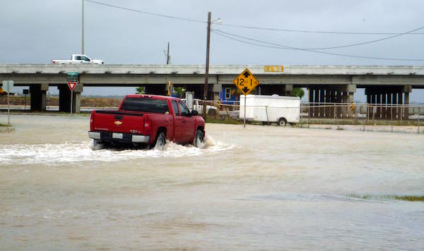
A truck takes its chances along a flooded Corpus Christi street. Photo by Carrie Robertson Meyer/Third Coast Photo
New flood plan maps released by the Federal Emergency Management Agency show large portions of Oso and La Volla creeks now included in flood zones. A series of public meetings have been set to hear from city residents before the maps are formally adopted. The entire process is expected to take several months.
The meetings held by the City of Corpus Christi Development Services Department are set for:
When: Monday, Dec. 7, 5:30 p.m.-6:30 p.m.
Where: Ethel Eyerly Senior Center, Flour Bluff, 645 Graham Road
When: Wednesday, Dec. 9, 5:30 p.m.-6:30 p.m.
Where: South Texas Botanical Gardens & Nature Center, 8545 S. Staples Street
When: Thursday, Dec 10, 5:30 p.m.-6:30 p.m.
Where: Holiday Inn Corpus Christi North Padre Island, 15202 Windward Drive
When: Friday, Dec. 11, 10:00 a.m.-2:00 p.m.
Where: Greenwood Senior Center, 4040 Greenwood Drive
For more information, please visit www.ccfema.com, which includes an interactive map that can provide detailed information about specific addresses. The website has information on current flood plain status vs proposed status.
The final maps will be used to determine mortgage and insurance rates as well as construction costs. Homes in the flood plains could be required to buy more expensive insurance, while new homes will have to meet higher building standards, increasing costs.
New flood maps also may be used to determine future city growth patterns, pushing the tendency to grow the Southside suburbs more toward expansion of high-rise living in urban and downtown areas.
City staff will be available at the meetings to answer questions and concerns about changes to the maps. They will also give feedback on citywide floodplain management.