
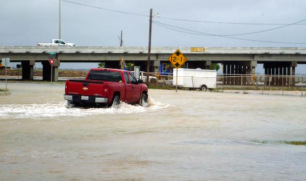
A truck takes its chances along a flooded Corpus Christi street. Photo by Carrie Robertson Meyer/Third Coast Photo
All of South Texas has been placed under a flash flood watch from Saturday morning Oct. 24 through Sunday evening Oct. 25, announced the National Weather Service on Friday, Oct. 23. Six to eight inches of rain are expected throughout the Coastal Bend, especially in eastern parts of South Texas. Storm surges are expected with gusty winds up to 45 miles per hour. Isolated tornadoes may be possible Saturday night and Sunday.
Forecasts show the slow moving storm system actually slowing down, causing rainy weather to linger into Sunday. Wind and waves along the gulf are also coming in much stronger than originally predicted.
Parts of the city already showed signs of flooding by Thursday evening and Friday morning, particularly in parts of North Beach. All along the beaches on Mustang and Padre Islands, high tides coupled with the high winds and rough surf have flooded beaches up to the dunes. Tides are 1 to 2 feet above predicted levels. Flooding is expected to occurr along Laguna Shores Drive, North Beach, Ingleside on the Bay and Fulton Beach Road.
Rip currents are a high risk throughout the weekend. If caught in a rip current, which is a strong flow of water moving from the shore out to sea, try to swim parallel to shore while calling for help. Stay calm, experts advise. Best advice is to stay out of the water during story weather.
The marina has issued small craft advisory conditions throughout the weekend.
Near record levels of moisture are expected, the NWS reports, as two major storm fronts converge over South Texas. Remnants of Hurricane Patricia in the Pacific Ocean, which is moving east over Mexico and Texas, will meet an upper level storm system coming in west from the Gulf of Mexico. Thunderstorms and heavy rain could cause flash flooding.
Conditions are expected to improve by Monday, Oct. 26. Northwest to north winds should help to reduce tide levels to near normal by Tuesday, according to Corpus Christi city officials.
FLOOD SAFETY
The difference between a flash flood warning and flash flood watch is the level of action you need to take. A “watch” means to be prepared. These are issued when a specific weather patterns may become a nuisance, but are not necessarily life threatening.
A flash flood "warning" is issued when hazardous weather is coming or is already in the area. Flooding conditions exist under a warning.
To be prepared for a flood, each family or individual should have a communications plan and an emergency kit. You should know what to do in advance to prepare your home and your pets in the case of an emergency.
A communications plan should include designating someone as the central contact point for information about conditions and where everyone is. Also, be sure all your electronic devises used for communications are fully charged and ready to go. Take chargers with you when you leave.
Emergency kits should include enough food, water and medicine to last you and your family at least three days. Keep food that needs little preparation as utility service may be unavailable.You may also need flashlights, blankets, first aid kit, rubber boots and gloves and a NOAA weather radio.
Finally, pack in advance for possible evacuation.
For more tips on how to be prepared for flooding and other emergencies, check out the NOAA website.