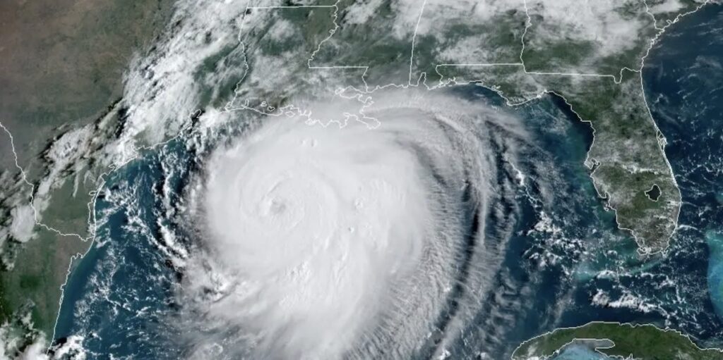
The center of Hurricane Laura, a Category 3 storm as of Wednesday morning, Aug. 25, will pass 200-300 miles north of the Coastal Bend. The region will still feel the effects of its storm surge and possible flooding, according to the National Weather Service.
The area is under a small craft advisory until 3 p.m. Thursday, Aug. 27, and a coastal flood advisory until 7 p.m. the same day. Nueces and San Patricio counties are included in the 23 counties listed in a state disaster declaration by Governor Greg Abbott.
Storm surge in the Coastal Bend is expected to rise as high as 10-15 feet or more east of Laura’s center. It is expected to hit the Texas-Louisiana border as a Category 4 hurricane sometime Wednesday evening, Aug. 26.
In the Corpus Christi and Port Aransas area, the storm will bring rough surf and wave sweeps as high as 9-11 feet, along with higher-than-normal tides of 1-3 feet. Risk of rip tides also will be high. Surfers are encouraged to pass up the temptation to ride the waves.
National Hurricane Director Ken Graham called the storm catastrophic and life threatening for those in its direct path.
“Every little bayou, every little river that normally drains, your rain is going to flow in the opposite direction with storm surge,” he told reporters, referring to the Texas-Louisiana border area. “And it will get out of those banks and go over the land.”
Parts of Texas and Louisiana have issued mandatory or voluntary evacuation orders affecting about 1.5 million people.
Although not in the direct path of the storm, Houston is expected to be hit hard with tropical storm-level damaging winds and flooding rains. The National Weather Service issued a hurricane warning from Galveston to Intracoastal City, Louisiana, south of Lafayette.
The winds of a Category 4 hurricane blow at 130-156 mph. Category 3 winds track at 111-129 mph. The worst hurricane, a Category 5, packs a punch of 157 mph or higher.
Only five Cat 5 storms have hit the United States since 1924. The last was Hurricane Katrina, which made landfall in Louisiana and Mississippi in August 2005.
The deadliest recorded hurricane, which occurred before storms were named, hit Galveston as a Category 4 in September 1900. It is believed to have killed more than 6,000 people.
Hurricane Laura misses Corpus Christi; still brings surge

Hurricane Laura is expected to be a Category 4 storm when it hits the Texas-Louisiana border late Wednesday, Aug. 26. Its storm surge and rain will bring flooding to the Coastal Bend, 200-300 miles south of the hurricane's center. Image courtesy of NOAA